")
Marine habitat characterization is crucial for assessing resources at risk, identifying ecological services, and developing mitigation measures for the offshore energy industry.
In deep water, remotely operated vehicles (ROVs) equipped with high-resolution digital cameras and lighting are often used to accomplish the collection of imagery that can be used to examine and interpret seafloor features, including the identification of sensitive benthic habitats (e.g., hard grounds and seeps).
CSA Ocean Sciences Inc. (CSA) has been providing this service to the offshore industry since the 1980s when US regulations sought to limit potential impacts to marine habitats on the continental shelf. These early large-scale habitat characterization programs were instrumental in developing CSA benthic specialist expertise specific to taxonomy, natural history aspects of marine habitats, and broad familiarity with substrate and biological associations. CSA’s provision of these services continues with various programs and methods to address concerns for maintaining biodiversity and sustainability during offshore resource development.
Typically, comprehensive habitat characterization in deep water is accomplished using a tiered approach involving the collection and interpretation of acoustic and geophysical data followed by the collection and analysis of visual data, both using remote sensing tools. Representative images concerning habitat characterization are provided below.
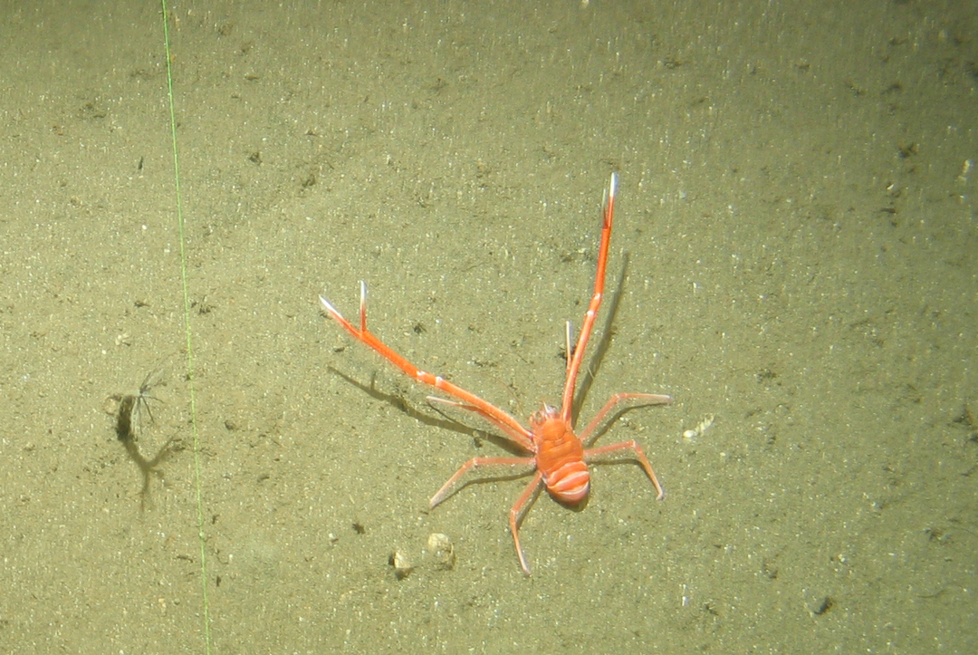 Image of a marine decapod crustacean of the genus Munida, commonly known as the squat lobster, collected offshore Senegal in a water depth of 300 m. (Image credit: CSA Ocean Sciences)
Remote Survey Capabilities
A recent post-drilling inspection involved reconnaissance and visual documentation of acoustically-identified seafloor features to determine the presence or absence of high-density benthic communities in compliance with Federally-outlined industry best practices for protecting these ![]() deepwater benthic communities. The key to this recent project was that CSA scientists provided expertise and image interpretation remotely, without being deployed offshore to work on a vessel.
deepwater benthic communities. The key to this recent project was that CSA scientists provided expertise and image interpretation remotely, without being deployed offshore to work on a vessel.
The real-time remote benthic habitat assessment used a Starlink broadband satellite internet system to convey imagery collected by ROV teams working offshore to CSA benthic specialists working onshore. Combining technology and safety, this approach enables scientists to work closely with offshore teams to accomplish survey objectives without physically joining the vessel.
Decommissioning Assessments in GOM
In another recent project to assess decommissioning options for aged offshore platforms in the Gulf of Mexico, CSA scientists joined a decommissioning team offshore to examine ROV imagery carefully collected in the vicinity of platform structures. The objective of the project was to guide the collection of imagery and samples and to identify and characterize the epibenthic assemblages on the platforms and associated subsea infrastructure.
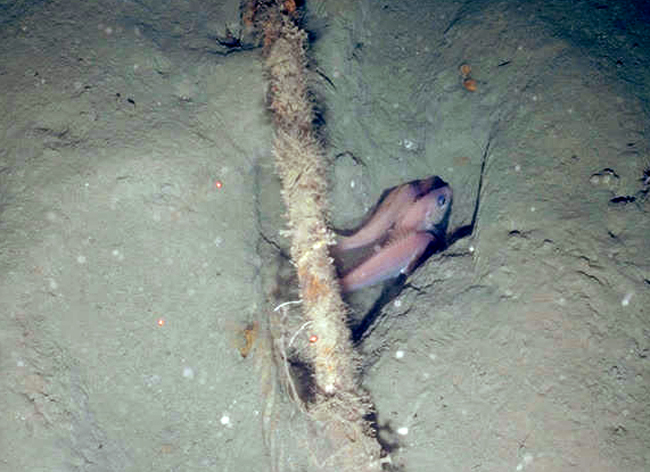 Image of a small group of wenchman snapper of the genus Pristipomoides, collected in the western Gulf of Mexico in a water depth of 200 m. (Image credit: CSA Ocean Sciences)
In both cases, real-time assessments by CSA scientists enabled the offshore industry to characterize benthic habitats not only in compliance with regulations, but also to identify and protect sensitive habitats.
Because few projects involve the collection of biological samples, the quality of these visual data is critical to their analysis and interpretation. Likewise, the expertise of the benthic specialist and their familiarity with the biota is important to enable recognition of biota and geologic features found on the seafloor in the deep ocean. To address the matter of quality data collection using ROVs in deepwater environments, CSA has developed a standard operating procedure for videographic data and image collection using ROVs, emphasizing the use of high-definition cameras and piloting the ROV over the seafloor in a particular manner to meet the data and image quality requirements of the analysis. High-quality visual data facilitates categorization of observed benthic habitats using various density-based classification schemes, including the Southeastern United States Deep Sea Corals (SEADESC) system and other methods. Standardization of collection methods will aid in understanding the benthic resources present and their subsequent effective management.