Teledyne Geospatial will exhibit their latest hardware and software survey and mapping solutions at InterGEO 2022, being held in Essen, Germany, October 18-20, 2022.
On display in Hall 1, booth F1.018 will be an impressive lineup of airborne, topographic and marine mapping systems demonstrating the single source capability of Teledyne. At the booth you can learn about:
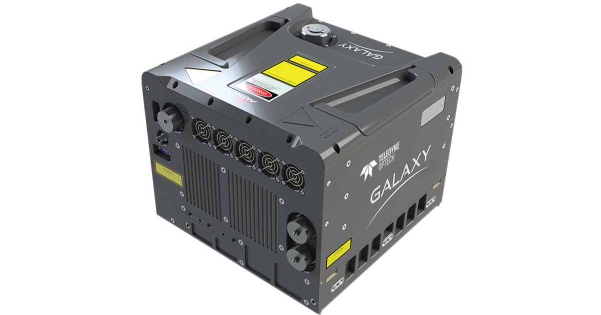
- Galaxy T2000 airborne terrain mapper optimal for delivering precision data in challenging terrain, weather and vegetation.
- The G2 sensor system combines two Galaxy sensor heads and a 150MP camera over a standard 19" aircraft sensor portal to deliver an astounding 4 million points per second.
- The latest addition to the Optech Compact Lidar family of products, the CLS-A.
- Optech CZMIL Super Nova, the 2022 MAPPS Grand Award winner, CZMIL SuperNova has the best water penetration capability in the commercial market, with over 4 times the nominal optical water clarity, allowing unprecedented class-leading coverage and detail in less-than optimal conditions.
- Designed for permanent monitoring applications, the new TLS M3 combines the measurement efficiency of the tripod based lidar system with a complete internal sensors package, weather resistance and API software.
- Teledyne FLIR’s all-new Ladybug6® delivers remarkable quality and spatial accuracy in 360-degree spherical imaging. The Ladybug6 is designed from the ground up to capture images from moving platforms in outdoor environments.
- Teledyne Marine’s Z-boat 1800RP equipped with the latest multibeam sonar the SeaBat T20-ASV.
The Teledyne booth will feature exhibits in “reality capture”, “airborne mapping”, and “marine solutions” featuring the Teledyne Marine Z-Boat mounted with a CL-360, and visitors will see a display of how Teledyne can provide a full solution for both land and water mapping.
There will also be a live stage area with ongoing presentations daily from product management in rotation throughout the duration of the show. Visitors can enjoy product presentations and unique case studies featuring all our products from our product experts.
Guests to the booth will also learn about limited-time promotions available to them.
Teledyne Geospatial unifies the hardware and software expertise of both Teledyne CARIS and Teledyne Optech. The new group provides customers with innovative integrated solutions. Offerings include turnkey systems, lidar and sonar integrated workflows and a range of systems and solutions that support holistic, precision data collection.